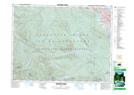
Maps showing Englishman River Falls, Nanoose Land District, British Columbia
Englishman River Falls is a Falls located in Nanoose Land District, British Columbia and has an elevation of 173 meters.
- Latitude: 49° 14' 38'' North (decimal: 49.2438888)
- Longitude: 124° 20' 54'' West (decimal: -124.3483333)
- Topography Feature Category: Falls
- Geographical Feature: Falls
- Canadian Province/Territory: British Columbia
- Elevation: 173 meters
- Location: Nanoose Land District
- Atlas of Canada Locator Map: Englishman River Falls
- GPS Coordinate Locator Map: Englishman River Falls Lat/Long
Englishman River Falls NTS Map Sheets