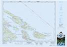
Maps showing Ballingall Islets Park, Cowichan Land District, British Columbia
Ballingall Islets Park is a Conservation area located in Cowichan Land District, British Columbia.
- Latitude: 48° 54' 20'' North (decimal: 48.905556)
- Longitude: 123° 27' 00'' West (decimal: -123.4499998)
- Topography Feature Category: Conservation area
- Geographical Feature: Provincial Park
- Canadian Province/Territory: British Columbia
- Location: Cowichan Land District
- Atlas of Canada Locator Map: Ballingall Islets Park
- GPS Coordinate Locator Map: Ballingall Islets Park Lat/Long
Ballingall Islets Park NTS Map Sheets