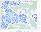
Maps showing The Camels Back, Lillooet Land District, British Columbia
The Camels Back is a Mountain located in Lillooet Land District, British Columbia.
- Latitude: 50° 29' 11'' North (decimal: 50.4863889)
- Longitude: 123° 0' 20'' West (decimal: -123.005556)
- Topography Feature Category: Mountain
- Geographical Feature: Mountain
- Canadian Province/Territory: British Columbia
- Location: Lillooet Land District
- Atlas of Canada Locator Map: The Camels Back
- GPS Coordinate Locator Map: The Camels Back Lat/Long
The Camels Back NTS Map Sheets