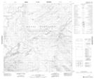
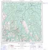
Maps showing Dease River Indian Reserve 2, Cassiar Land District, British Columbia
Dease River Indian Reserve 2 is a Indian Reserve located in Cassiar Land District, British Columbia.
- Latitude: 59° 43' 9'' North (decimal: 59.7191666)
- Longitude: 128° 55' 23'' West (decimal: -128.9230556)
- Topography Feature Category: Indian Reserve
- Geographical Feature: Indian Reserve
- Canadian Province/Territory: British Columbia
- Location: Cassiar Land District
- Atlas of Canada Locator Map: Dease River Indian Reserve 2
- GPS Coordinate Locator Map: Dease River Indian Reserve 2 Lat/Long