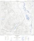
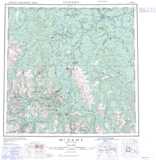
Maps showing Dease River Indian Reserve 3, Cassiar Land District, British Columbia
Dease River Indian Reserve 3 is a Indian Reserve located in Cassiar Land District, British Columbia.
- Latitude: 59° 19' 0'' North (decimal: 59.316667)
- Longitude: 129° 2' 00'' West (decimal: -129.03333)
- Topography Feature Category: Indian Reserve
- Geographical Feature: Indian Reserve
- Canadian Province/Territory: British Columbia
- Location: Cassiar Land District
- Atlas of Canada Locator Map: Dease River Indian Reserve 3
- GPS Coordinate Locator Map: Dease River Indian Reserve 3 Lat/Long
Dease River Indian Reserve 3 NTS Map Sheets