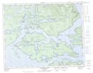
Maps showing Catherine Hill, Range 1 Coast Land District, British Columbia
Catherine Hill is a Mountain located in Range 1 Coast Land District, British Columbia.
- Latitude: 50° 56' 30'' North (decimal: 50.9416667)
- Longitude: 126° 50' 40'' West (decimal: -126.844444)
- Topography Feature Category: Mountain
- Geographical Feature: Hill
- Canadian Province/Territory: British Columbia
- Location: Range 1 Coast Land District
- Atlas of Canada Locator Map: Catherine Hill
- GPS Coordinate Locator Map: Catherine Hill Lat/Long
Catherine Hill NTS Map Sheets