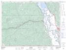
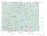
Maps showing Duck Creek (Wynndel P.O.-B. de p.), Kootenay Land District, British Columbia
Duck Creek (Wynndel P.O.-B. de p.) is a Unincorporated area located in Kootenay Land District, British Columbia.
- Latitude: 49° 11' North (decimal: 49.1833328)
- Longitude: 116° 33' West (decimal: -116.55)
- Topography Feature Category: Unincorporated area
- Geographical Feature: Former Railway Point
- Canadian Province/Territory: British Columbia
- Location: Kootenay Land District
- Atlas of Canada Locator Map: Duck Creek (Wynndel P.O.-B. de p.)
- GPS Coordinate Locator Map: Duck Creek (Wynndel P.O.-B. de p.) Lat/Long