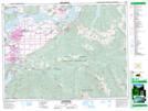
Maps showing Cheam Range, Yale Division Yale Land District, British Columbia
Cheam Range is a Mountain located in Yale Division Yale Land District, British Columbia.
- Latitude: 49° 11' North (decimal: 49.1833000)
- Longitude: 121° 40' West (decimal: -121.6666999)
- Topography Feature Category: Mountain
- Geographical Feature: Range
- Canadian Province/Territory: British Columbia
- Location: Yale Division Yale Land District
- GPS Coordinate Locator Map: Cheam Range Lat/Long