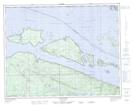
Maps showing Gordon Group, Rupert Land District, British Columbia
Gordon Group is a Island located in Rupert Land District, British Columbia.
- Latitude: 50° 48' 54'' North (decimal: 50.815)
- Longitude: 127° 28' 47'' West (decimal: -127.479722)
- Topography Feature Category: Island
- Geographical Feature: Islands
- Canadian Province/Territory: British Columbia
- Location: Rupert Land District
- GPS Coordinate Locator Map: Gordon Group Lat/Long
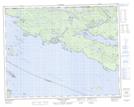
Gordon Group NTS Map Sheets