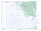
Maps showing The Twins, British Columbia
The Twins is a Island located in British Columbia.
- Latitude: 49° 49' North (decimal: 49.8166999)
- Longitude: 127° 3' West (decimal: -127.0499999)
- Topography Feature Category: Island
- Geographical Feature: Islands
- Canadian Province/Territory: British Columbia
- GPS Coordinate Locator Map: The Twins Lat/Long
The Twins NTS Map Sheets