Canada Topographic Maps

Seymour Ridge Topo Maps

Topography maps and Latitude/Longitude Location

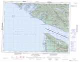
Maps showing Seymour Ridge, Cowichan Land District, British Columbia

Seymour Ridge is a Mountain located in Cowichan Land District, British Columbia.

  • Latitude: 48° 43' North   (decimal: 48.7167000)
  • Longitude: 124° 11' West   (decimal: -124.1832999)
  • Topography Feature Category: Mountain
  • Geographical Feature: Ridge
  • Canadian Province/Territory: British Columbia
  • Location: Cowichan Land District
  • GPS Coordinate Locator Map: Seymour Ridge Lat/Long

Seymour Ridge NTS Map Sheets

092B12 Shawnigan Lake Topographic Map at 1:50,000 scale

092B13 Duncan Topographic Map at 1:50,000 scale

092C09 Port Renfrew Topographic Map at 1:50,000 scale

092C16 Cowichan Lake Topographic Map at 1:50,000 scale

092B Victoria Topographic Map at 1:250,000 scale

092C Cape Flattery Topographic Map at 1:250,000 scale

 
Buy Topographic Maps DVD
Newsletter Sign-up

Yes, I want to receive map store discounts.


Bookmark and Share