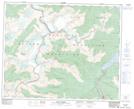
Maps showing Dutchman's Creek, Kootenay Land District, British Columbia
Dutchman's Creek is a River located in Kootenay Land District, British Columbia.
- Latitude: 52° 5' 11'' North (decimal: 52.0863889)
- Longitude: 118° 34' 38'' West (decimal: -118.577222)
- Topography Feature Category: River
- Geographical Feature: Creek
- Canadian Province/Territory: British Columbia
- Location: Kootenay Land District
- Atlas of Canada Locator Map: Dutchman's Creek
- GPS Coordinate Locator Map: Dutchman's Creek Lat/Long
Dutchman's Creek NTS Map Sheets