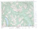
Maps showing Mount Andrews, Yale Division Yale Land District, British Columbia
Mount Andrews is a Mountain located in Yale Division Yale Land District, British Columbia.
- Latitude: 49° 7' 53'' North (decimal: 49.1313888)
- Longitude: 121° 4' 52'' West (decimal: -121.0811111)
- Topography Feature Category: Mountain
- Geographical Feature: Mount
- Canadian Province/Territory: British Columbia
- Location: Yale Division Yale Land District
- Atlas of Canada Locator Map: Mount Andrews
- GPS Coordinate Locator Map: Mount Andrews Lat/Long