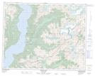
Maps showing Dupont Creek, Range 1 Coast Land District, British Columbia
Dupont Creek is a River located in Range 1 Coast Land District, British Columbia.
- Latitude: 50° 35' 51'' North (decimal: 50.5975)
- Longitude: 124° 51' 7'' West (decimal: -124.851944)
- Topography Feature Category: River
- Geographical Feature: Creek
- Canadian Province/Territory: British Columbia
- Location: Range 1 Coast Land District
- Atlas of Canada Locator Map: Dupont Creek
- GPS Coordinate Locator Map: Dupont Creek Lat/Long
Dupont Creek NTS Map Sheets