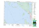
Maps showing Valentine Hill, New Westminster Land District, British Columbia
Valentine Hill is a Mountain located in New Westminster Land District, British Columbia.
- Latitude: 49° 52' 55'' North (decimal: 49.8819444)
- Longitude: 124° 32' 21'' West (decimal: -124.5391666)
- Topography Feature Category: Mountain
- Geographical Feature: Hill
- Canadian Province/Territory: British Columbia
- Location: New Westminster Land District
- Atlas of Canada Locator Map: Valentine Hill
- GPS Coordinate Locator Map: Valentine Hill Lat/Long
Valentine Hill NTS Map Sheets