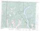
Maps showing Boulding Bog, Comox Land District, British Columbia
Boulding Bog is a Low vegetation located in Comox Land District, British Columbia.
- Latitude: 49° 53' North (decimal: 49.8833000)
- Longitude: 125° 38' West (decimal: -125.6333000)
- Topography Feature Category: Low vegetation
- Geographical Feature: Bog
- Canadian Province/Territory: British Columbia
- Location: Comox Land District
- Atlas of Canada Locator Map: Boulding Bog
- GPS Coordinate Locator Map: Boulding Bog Lat/Long
Boulding Bog NTS Map Sheets