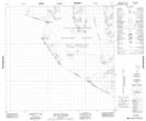
Maps showing Elephant Promontory, Cassiar Land District, British Columbia
Elephant Promontory is a Mountain located in Cassiar Land District, British Columbia.
- Latitude: 58° 49' 1'' North (decimal: 58.8169444)
- Longitude: 134° 7' 29'' West (decimal: -134.1247222)
- Topography Feature Category: Mountain
- Geographical Feature: Peak
- Canadian Province/Territory: British Columbia
- Location: Cassiar Land District
- Atlas of Canada Locator Map: Elephant Promontory
- GPS Coordinate Locator Map: Elephant Promontory Lat/Long
Elephant Promontory NTS Map Sheets
104L Map Not Available Topographic Map at 1:250,000 scale
