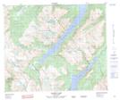
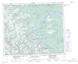
Maps showing Utem Glacier, Range 4 Coast Land District, British Columbia
Utem Glacier is a Glacier located in Range 4 Coast Land District, British Columbia.
- Latitude: 53° 54' 30'' North (decimal: 53.9083329)
- Longitude: 127° 47' 00'' West (decimal: -127.7833299)
- Topography Feature Category: Glacier
- Geographical Feature: Glacier
- Canadian Province/Territory: British Columbia
- Location: Range 4 Coast Land District
- Atlas of Canada Locator Map: Utem Glacier
- GPS Coordinate Locator Map: Utem Glacier Lat/Long
Utem Glacier NTS Map Sheets