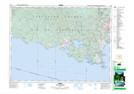
Maps showing Camas Hill, GoldstreamLand District, British Columbia
Camas Hill is a Mountain located in GoldstreamLand District, British Columbia and has an elevation of 170 meters.
- Latitude: 48° 23' 55'' North (decimal: 48.3986111)
- Longitude: 123° 35' 52'' West (decimal: -123.5977777)
- Topography Feature Category: Mountain
- Geographical Feature: Hill
- Canadian Province/Territory: British Columbia
- Elevation: 170 meters
- Location: GoldstreamLand District
- Atlas of Canada Locator Map: Camas Hill
- GPS Coordinate Locator Map: Camas Hill Lat/Long