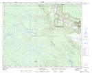
Maps showing Deer Creek, Lillooet Land District, British Columbia
Deer Creek is a River located in Lillooet Land District, British Columbia.
- Latitude: 51° 56' 59'' North (decimal: 51.9497222)
- Longitude: 123° 22' 14'' West (decimal: -123.3705555)
- Topography Feature Category: River
- Geographical Feature: Creek
- Canadian Province/Territory: British Columbia
- Location: Lillooet Land District
- Atlas of Canada Locator Map: Deer Creek
- GPS Coordinate Locator Map: Deer Creek Lat/Long
Deer Creek NTS Map Sheets