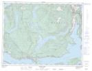
Maps showing Lac Godeau, New Westminster Land District, British Columbia
Lac Godeau is a Lake located in New Westminster Land District, British Columbia.
- Latitude: 49° 58' 51'' North (decimal: 49.9808333)
- Longitude: 124° 20' 49'' West (decimal: -124.346944)
- Topography Feature Category: Lake
- Geographical Feature: Lake
- Canadian Province/Territory: British Columbia
- Location: New Westminster Land District
- Atlas of Canada Locator Map: Lac Godeau
- GPS Coordinate Locator Map: Lac Godeau Lat/Long
Lac Godeau NTS Map Sheets