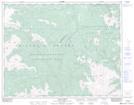
Maps showing Castle Pass, Lillooet Land District, British Columbia
Castle Pass is a Valley located in Lillooet Land District, British Columbia and has an elevation of 2256 meters.
- Latitude: 51° 5' 5'' North (decimal: 51.0847000)
- Longitude: 122° 57' 30'' West (decimal: -122.9583000)
- Topography Feature Category: Valley
- Geographical Feature: Pass
- Canadian Province/Territory: British Columbia
- Elevation: 2256 meters
- Location: Lillooet Land District
- Atlas of Canada Locator Map: Castle Pass
- GPS Coordinate Locator Map: Castle Pass Lat/Long
Castle Pass NTS Map Sheets