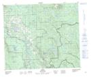
Maps showing Coffin Creek, Range 5 Coast Land District, British Columbia
Coffin Creek is a River located in Range 5 Coast Land District, British Columbia.
- Latitude: 54° 37' 25'' North (decimal: 54.6236000)
- Longitude: 126° 55' 0'' West (decimal: -126.9166999)
- Topography Feature Category: River
- Geographical Feature: Creek
- Canadian Province/Territory: British Columbia
- Location: Range 5 Coast Land District
- Atlas of Canada Locator Map: Coffin Creek
- GPS Coordinate Locator Map: Coffin Creek Lat/Long