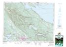
Maps showing The Squarehead, Newcastle Land District, British Columbia
The Squarehead is a Mountain located in Newcastle Land District, British Columbia and has an elevation of 1294 meters.
- Latitude: 49° 25' 33'' North (decimal: 49.4258333)
- Longitude: 124° 54' 59'' West (decimal: -124.9163888)
- Topography Feature Category: Mountain
- Geographical Feature: Mountain
- Canadian Province/Territory: British Columbia
- Elevation: 1294 meters
- Location: Newcastle Land District
- Atlas of Canada Locator Map: The Squarehead
- GPS Coordinate Locator Map: The Squarehead Lat/Long
The Squarehead NTS Map Sheets