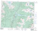
Maps showing Blue River West, Kamloops Division Yale Land District, British Columbia
Blue River West is a Unincorporated area located in Kamloops Division Yale Land District, British Columbia.
- Latitude: 52° 5' 20'' North (decimal: 52.0888999)
- Longitude: 119° 18' 20'' West (decimal: -119.3056000)
- Topography Feature Category: Unincorporated area
- Geographical Feature: Railway Point
- Canadian Province/Territory: British Columbia
- Location: Kamloops Division Yale Land District
- Atlas of Canada Locator Map: Blue River West
- GPS Coordinate Locator Map: Blue River West Lat/Long
Blue River West NTS Map Sheets