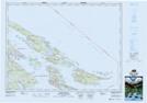
Maps showing Hope Bay (Pender Island P.O.-B. de p.), Cowichan Land District, British Columbia
Hope Bay (Pender Island P.O.-B. de p.) is a Unincorporated area located in Cowichan Land District, British Columbia.
- Latitude: 48° 48' North (decimal: 48.8000000)
- Longitude: 123° 16' West (decimal: -123.2667000)
- Topography Feature Category: Unincorporated area
- Geographical Feature: Landing
- Canadian Province/Territory: British Columbia
- Location: Cowichan Land District
- GPS Coordinate Locator Map: Hope Bay (Pender Island P.O.-B. de p.) Lat/Long
Hope Bay (Pender Island P.O.-B. de p.) NTS Map Sheets