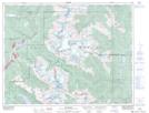
Maps showing Whistler Creek, New Westminster Land District, British Columbia
Whistler Creek is a Unincorporated area located in New Westminster Land District, British Columbia and has an elevation of 677 meters.
- Latitude: 50° 5' 45'' North (decimal: 50.0958333)
- Longitude: 122° 59' 35'' West (decimal: -122.9930555)
- Topography Feature Category: Unincorporated area
- Geographical Feature: Community
- Canadian Province/Territory: British Columbia
- Elevation: 677 meters
- Location: New Westminster Land District
- Atlas of Canada Locator Map: Whistler Creek
- GPS Coordinate Locator Map: Whistler Creek Lat/Long