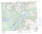
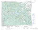
Maps showing Mount Hugh Neave, Kamloops Division Yale Land District, British Columbia
Mount Hugh Neave is a Mountain located in Kamloops Division Yale Land District, British Columbia.
- Latitude: 52° 30' 35'' North (decimal: 52.5097000)
- Longitude: 120° 13' 40'' West (decimal: -120.2278000)
- Topography Feature Category: Mountain
- Geographical Feature: Mount
- Canadian Province/Territory: British Columbia
- Location: Kamloops Division Yale Land District
- Atlas of Canada Locator Map: Mount Hugh Neave
- GPS Coordinate Locator Map: Mount Hugh Neave Lat/Long
Mount Hugh Neave NTS Map Sheets