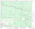
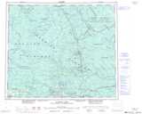
Maps showing Gilbert Creek, Range 5 Coast Land District, British Columbia
Gilbert Creek is a River located in Range 5 Coast Land District, British Columbia.
- Latitude: 54° 3' 10'' North (decimal: 54.0527999)
- Longitude: 123° 53' 20'' West (decimal: -123.8888999)
- Topography Feature Category: River
- Geographical Feature: Creek
- Canadian Province/Territory: British Columbia
- Location: Range 5 Coast Land District
- Atlas of Canada Locator Map: Gilbert Creek
- GPS Coordinate Locator Map: Gilbert Creek Lat/Long
Gilbert Creek NTS Map Sheets