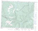
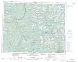
Maps showing Shepherds Valley, Kamloops Division Yale Land District, British Columbia
Shepherds Valley is a Valley located in Kamloops Division Yale Land District, British Columbia.
- Latitude: 51° 47' 20'' North (decimal: 51.7889000)
- Longitude: 119° 55' 10'' West (decimal: -119.9194000)
- Topography Feature Category: Valley
- Geographical Feature: Valley
- Canadian Province/Territory: British Columbia
- Location: Kamloops Division Yale Land District
- Atlas of Canada Locator Map: Shepherds Valley
- GPS Coordinate Locator Map: Shepherds Valley Lat/Long
Shepherds Valley NTS Map Sheets