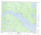
Maps showing Sunnyside Reef, Range 5 Coast Land District, British Columbia
Sunnyside Reef is a Shoal located in Range 5 Coast Land District, British Columbia.
- Latitude: 54° 38' 10'' North (decimal: 54.6361000)
- Longitude: 124° 42' 18'' West (decimal: -124.7049999)
- Topography Feature Category: Shoal
- Geographical Feature: Reef
- Canadian Province/Territory: British Columbia
- Location: Range 5 Coast Land District
- Atlas of Canada Locator Map: Sunnyside Reef
- GPS Coordinate Locator Map: Sunnyside Reef Lat/Long
Sunnyside Reef NTS Map Sheets