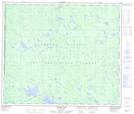
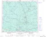
Maps showing Carrier Lake Indian Reserve 15, Cariboo Land District, British Columbia
Carrier Lake Indian Reserve 15 is a Indian Reserve located in Cariboo Land District, British Columbia.
- Latitude: 54° 31' 15'' North (decimal: 54.5208330)
- Longitude: 123° 53' 20'' West (decimal: -123.8888899)
- Topography Feature Category: Indian Reserve
- Geographical Feature: Indian Reserve
- Canadian Province/Territory: British Columbia
- Location: Cariboo Land District
- Atlas of Canada Locator Map: Carrier Lake Indian Reserve 15
- GPS Coordinate Locator Map: Carrier Lake Indian Reserve 15 Lat/Long
Carrier Lake Indian Reserve 15 NTS Map Sheets