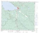
Maps showing Réserve indienne Necoslie (Fort St. James) 1, Range 5 Coast Land District, British Columbia
Réserve indienne Necoslie (Fort St. James) 1 is a Indian Reserve located in Range 5 Coast Land District, British Columbia.
- Latitude: 54° 25' 45'' North (decimal: 54.4291666)
- Longitude: 124° 14' 40'' West (decimal: -124.2444444)
- Topography Feature Category: Indian Reserve
- Geographical Feature: Réserve indienne
- Canadian Province/Territory: British Columbia
- Location: Range 5 Coast Land District
- Atlas of Canada Locator Map: Réserve indienne Necoslie (Fort St. James) 1
- GPS Coordinate Locator Map: Réserve indienne Necoslie (Fort St. James) 1 Lat/Long
Réserve indienne Necoslie (Fort St. James) 1 NTS Map Sheets