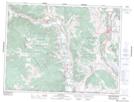
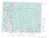
Maps showing Chopaka Indian Reserve 7 & 8, Similkameen Division Yale Land District, British Columbia
Chopaka Indian Reserve 7 & 8 is a Indian Reserve located in Similkameen Division Yale Land District, British Columbia.
- Latitude: 49° 2' 35'' North (decimal: 49.0430558)
- Longitude: 119° 43' 5'' West (decimal: -119.71806)
- Topography Feature Category: Indian Reserve
- Geographical Feature: Indian Reserve
- Canadian Province/Territory: British Columbia
- Location: Similkameen Division Yale Land District
- Atlas of Canada Locator Map: Chopaka Indian Reserve 7 & 8
- GPS Coordinate Locator Map: Chopaka Indian Reserve 7 & 8 Lat/Long