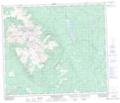
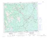
Maps showing Tamara Brook, Range 3 Coast Land District, British Columbia
Tamara Brook is a River located in Range 3 Coast Land District, British Columbia.
- Latitude: 54° 48' 42'' North (decimal: 54.8116666)
- Longitude: 126° 58' 55'' West (decimal: -126.9819444)
- Topography Feature Category: River
- Geographical Feature: Brook
- Canadian Province/Territory: British Columbia
- Location: Range 3 Coast Land District
- Atlas of Canada Locator Map: Tamara Brook
- GPS Coordinate Locator Map: Tamara Brook Lat/Long
Tamara Brook NTS Map Sheets