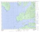
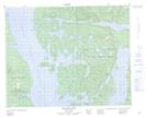
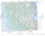
Maps showing Penrose Island Marine Park, Range 2 Coast Land District, British Columbia
Penrose Island Marine Park is a Conservation area located in Range 2 Coast Land District, British Columbia.
- Latitude: 51° 27' 40'' North (decimal: 51.4610999)
- Longitude: 127° 44' 00'' West (decimal: -127.7333000)
- Topography Feature Category: Conservation area
- Geographical Feature: Provincial Marine Park
- Canadian Province/Territory: British Columbia
- Location: Range 2 Coast Land District
- Atlas of Canada Locator Map: Penrose Island Marine Park
- GPS Coordinate Locator Map: Penrose Island Marine Park Lat/Long
Penrose Island Marine Park NTS Map Sheets