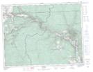
Maps showing Skwel Kwel Peken, Similkameen Division Yale Land District, British Columbia
Skwel Kwel Peken is a Mountain located in Similkameen Division Yale Land District, British Columbia.
- Latitude: 49° 16' 42'' North (decimal: 49.2783333)
- Longitude: 120° 7' 32'' West (decimal: -120.1255555)
- Topography Feature Category: Mountain
- Geographical Feature: Hill
- Canadian Province/Territory: British Columbia
- Location: Similkameen Division Yale Land District
- Atlas of Canada Locator Map: Skwel Kwel Peken
- GPS Coordinate Locator Map: Skwel Kwel Peken Lat/Long