Maps showing Highlands, Highland Land District, British Columbia
Highlands is a District municipality located in Highland Land District, British Columbia.
- Latitude: 48° 31' North (decimal: 48.5166668)
- Longitude: 123° 30' West (decimal: -123.4999998)
- Topography Feature Category: District municipality
- Geographical Feature: District Municipality
- Canadian Province/Territory: British Columbia
- Location: Highland Land District
- Atlas of Canada Locator Map: Highlands
- GPS Coordinate Locator Map: Highlands Lat/Long
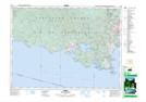
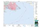
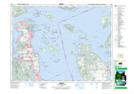
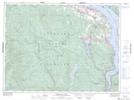
Highlands NTS Map Sheets