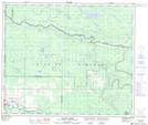
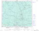
Maps showing Bernies Bog, Cariboo Land District, British Columbia
Bernies Bog is a Low vegetation located in Cariboo Land District, British Columbia.
- Latitude: 54° 5' 45'' North (decimal: 54.0957999)
- Longitude: 123° 37' 30'' West (decimal: -123.6249999)
- Topography Feature Category: Low vegetation
- Geographical Feature: Marsh
- Canadian Province/Territory: British Columbia
- Location: Cariboo Land District
- Atlas of Canada Locator Map: Bernies Bog
- GPS Coordinate Locator Map: Bernies Bog Lat/Long
Bernies Bog NTS Map Sheets