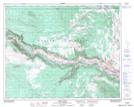
Maps showing Durrell Butte, Lillooet Land District, British Columbia
Durrell Butte is a Mountain located in Lillooet Land District, British Columbia.
- Latitude: 51° 54' 5'' North (decimal: 51.9013889)
- Longitude: 122° 40' 41'' West (decimal: -122.678056)
- Topography Feature Category: Mountain
- Geographical Feature: Butte
- Canadian Province/Territory: British Columbia
- Location: Lillooet Land District
- Atlas of Canada Locator Map: Durrell Butte
- GPS Coordinate Locator Map: Durrell Butte Lat/Long
Durrell Butte NTS Map Sheets