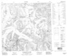
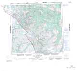
Maps showing Hang Ten Icefield, Cassiar Land District, British Columbia
Hang Ten Icefield is a Glacier located in Cassiar Land District, British Columbia.
- Latitude: 58° 52' 30'' North (decimal: 58.8749998)
- Longitude: 133° 43' 0'' West (decimal: -133.7166698)
- Topography Feature Category: Glacier
- Geographical Feature: Icefield
- Canadian Province/Territory: British Columbia
- Location: Cassiar Land District
- Atlas of Canada Locator Map: Hang Ten Icefield
- GPS Coordinate Locator Map: Hang Ten Icefield Lat/Long
Hang Ten Icefield NTS Map Sheets