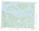
Maps showing Scottys Point, Range 1 Coast Land District, British Columbia
Scottys Point is a Cape located in Range 1 Coast Land District, British Columbia.
- Latitude: 50° 24' 55'' North (decimal: 50.415278)
- Longitude: 125° 54' 20'' West (decimal: -125.9055598)
- Topography Feature Category: Cape
- Geographical Feature: Point
- Canadian Province/Territory: British Columbia
- Location: Range 1 Coast Land District
- Atlas of Canada Locator Map: Scottys Point
- GPS Coordinate Locator Map: Scottys Point Lat/Long