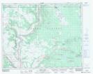
Maps showing Dead Miners Creek, Cariboo Land District, British Columbia
Dead Miners Creek is a River located in Cariboo Land District, British Columbia.
- Latitude: 51° 49' 15'' North (decimal: 51.8208333)
- Longitude: 122° 24' 20'' West (decimal: -122.4055555)
- Topography Feature Category: River
- Geographical Feature: Creek
- Canadian Province/Territory: British Columbia
- Location: Cariboo Land District
- Atlas of Canada Locator Map: Dead Miners Creek
- GPS Coordinate Locator Map: Dead Miners Creek Lat/Long
Dead Miners Creek NTS Map Sheets