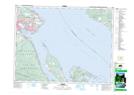
Maps showing Spence Creek, Nelson Land District, British Columbia
Spence Creek is a River located in Nelson Land District, British Columbia.
- Latitude: 49° 36' 20'' North (decimal: 49.6055555)
- Longitude: 124° 53' 40'' West (decimal: -124.8944444)
- Topography Feature Category: River
- Geographical Feature: Creek
- Canadian Province/Territory: British Columbia
- Location: Nelson Land District
- Atlas of Canada Locator Map: Spence Creek
- GPS Coordinate Locator Map: Spence Creek Lat/Long