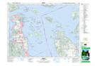
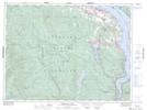
Maps showing Gowlland Tod Park, Highland Land District, British Columbia
Gowlland Tod Park is a Conservation area located in Highland Land District, British Columbia.
- Latitude: 48° 33' 00'' North (decimal: 48.5499999)
- Longitude: 123° 30' 30'' West (decimal: -123.5082999)
- Topography Feature Category: Conservation area
- Geographical Feature: Provincial Park
- Canadian Province/Territory: British Columbia
- Location: Highland Land District
- Atlas of Canada Locator Map: Gowlland Tod Park
- GPS Coordinate Locator Map: Gowlland Tod Park Lat/Long
Gowlland Tod Park NTS Map Sheets