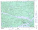
Maps showing Marble River Park, Rupert Land District, British Columbia
Marble River Park is a Conservation area located in Rupert Land District, British Columbia.
- Latitude: 50° 32' 30'' North (decimal: 50.5416999)
- Longitude: 127° 31' 30'' West (decimal: -127.5249999)
- Topography Feature Category: Conservation area
- Geographical Feature: Provincial Park
- Canadian Province/Territory: British Columbia
- Location: Rupert Land District
- Atlas of Canada Locator Map: Marble River Park
- GPS Coordinate Locator Map: Marble River Park Lat/Long