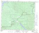
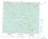
Maps showing Brewster Lakes, Range 4 Coast Land District, British Columbia
Brewster Lakes is a Lake located in Range 4 Coast Land District, British Columbia.
- Latitude: 53° 24' 45'' North (decimal: 53.4125000)
- Longitude: 124° 32' 25'' West (decimal: -124.5403000)
- Topography Feature Category: Lake
- Geographical Feature: Lakes
- Canadian Province/Territory: British Columbia
- Location: Range 4 Coast Land District
- Atlas of Canada Locator Map: Brewster Lakes
- GPS Coordinate Locator Map: Brewster Lakes Lat/Long
Brewster Lakes NTS Map Sheets