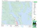
Maps showing Main Lakes Chain Park, Sayward Land District, British Columbia
Main Lakes Chain Park is a Conservation area located in Sayward Land District, British Columbia.
- Latitude: 50° 12' 50'' North (decimal: 50.2138889)
- Longitude: 125° 13' 0'' West (decimal: -125.216667)
- Topography Feature Category: Conservation area
- Geographical Feature: Provincial Park
- Canadian Province/Territory: British Columbia
- Location: Sayward Land District
- GPS Coordinate Locator Map: Main Lakes Chain Park Lat/Long
Main Lakes Chain Park NTS Map Sheets