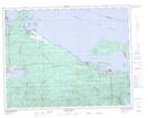
Maps showing Downey Hills, Rupert Land District, British Columbia
Downey Hills is a Mountain located in Rupert Land District, British Columbia.
- Latitude: 50° 39' 45'' North (decimal: 50.6624999)
- Longitude: 127° 29' 00'' West (decimal: -127.4833000)
- Topography Feature Category: Mountain
- Geographical Feature: Hills
- Canadian Province/Territory: British Columbia
- Location: Rupert Land District
- Atlas of Canada Locator Map: Downey Hills
- GPS Coordinate Locator Map: Downey Hills Lat/Long
Downey Hills NTS Map Sheets