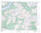
Maps showing Lockie's Table, Range 1 Coast Land District, British Columbia
Lockie's Table is a Mountain located in Range 1 Coast Land District, British Columbia.
- Latitude: 50° 15' 5'' North (decimal: 50.2513889)
- Longitude: 124° 17' 59'' West (decimal: -124.299722)
- Topography Feature Category: Mountain
- Geographical Feature: Peak
- Canadian Province/Territory: British Columbia
- Location: Range 1 Coast Land District
- Atlas of Canada Locator Map: Lockie's Table
- GPS Coordinate Locator Map: Lockie's Table Lat/Long
Lockie's Table NTS Map Sheets